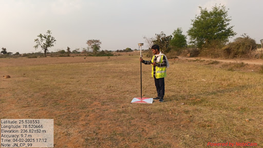
A DGPS survey is the process of using DGPS technology to determine the precise geographic coordin…
A DGPS survey is the process of using DGPS technology to determine the precise geographic coordinates (latitude, longitude, and often elevation) of specific points on the Earth's surface. Key Aspects of a DGPS Survey: * Objective: To obtain highly accurate positional data for mapping, boundary demarcation, construction layout, infrastructure monitoring, asset location, etc. * Equipment: * Base Station: A DGPS receiver set up over a known control point. * Rover Unit: One or more mobile DGPS receivers used to measure the unknown points. * Data Collector/Controller: A device (often handheld) used to manage the survey, record data, and sometimes control the rover. * Communication Link: Radio modems (or other means) to transmit corrections from the base to the rover(s). * Survey Software: For planning the survey, processing the collected data, and generating final outputs (maps, coordinate lists). * Techniques: * Real-Time Kinematic (RTK): The most common high-accuracy DGPS survey technique. Corrections are transmitted and applied in real-time, providing centimeter-level accuracy instantly in the field. Requires a continuous radio link. * Post-Processed Kinematic (PPK): Raw satellite data is recorded at both the base and rover simultaneously. Corrections are applied later using office software. Useful when a real-time radio link is unreliable or unavailable. Can achieve similar accuracy to RTK.