Total Station, DGPS, and Drone Survey now at 20% OFF.

Fresh stories, announcements and offers about Land Surveyor, Surveyor, Drone service, straight from our business.
Looking for reliable and accurate Lucknow land surveyors? We provide expert land surveying services across Lucknow using advanced equipment such as Total Station, DGPS, Drone Survey, and GIS Mapping. Our certified surveyors deliver high-precision land measurement for residential plots, commercial sites, farmland, industrial projects, and government approvals. ⭐ Why Choose Our Land Surveyors in Lucknow? High-accuracy Total Station Survey DGPS/GNSS Survey for precise coordinates Drone Survey & Topographical Mapping Boundary marking and site layout planning Fast and error-free CAD drawings Affordable pricing with quick report delivery Trusted by architects, builders, and property buyers 📌 Areas We Serve in Lucknow Gomti Nagar | Shaheed Path | Indira Nagar | Aliganj | Sultanpur Road | Faizabad Road | Mohanlalganj | Kakori | Amausi | Outer Ring Road & more 📌 SEO Keywords to Help You Rank Lucknow land surveyors Land survey service in Lucknow Total station survey in Lucknow DGPS survey Lucknow Drone survey Lucknow Property boundary survey Lucknow Best land surveyor in Lucknow 📞 Contact for Professional Land Survey Services Get accurate and affordable land measurement in Lucknow. Ideal for property purchase, construction planning, legal documentation, and development projects.

Celebrate Independence Day with Lucknow Land Surveyors! Get accurate land, boundary & contour surveys at special festive discounts. Professional, reliable & affordable survey solutions in Lucknow. Book now for expert mapping & layout services. #LucknowLandSurveyors #SurveyOffer"


Get accurate boundary, layout, topographic & construction surveys by licensed experts. Using drones, total stations & GPS. Affordable & reliable service. Call now for site inspection & quote.
At Lucknow Land Surveyors, we believe that understanding your land is the first step to financial growth! Located near Thomas Academy in Gaurabagh, our experts are here to support you with accurate and reliable land surveying services. We’re passionate about helping our community achieve their financial goals through smart, informed choices. Come say hello and discover how we can assist you—let’s build your future together!
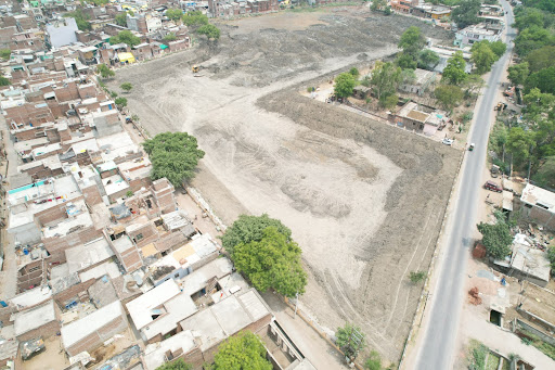
Welcome to Lucknow Land Surveyors, your trusted partner in smart land investments right here on Kursi Highway! Our friendly team specializes in precise land surveys, helping you make confident financial decisions every step of the way. Whether you're planning to buy, sell, or invest, let us guide you to success. Visit us near Thomas Academy in Jankipuram Garden today and let's make your land investment dreams a reality!

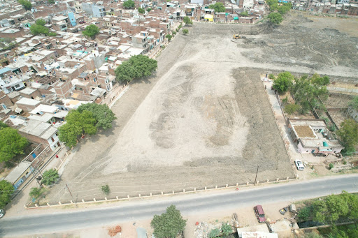
Our drone surveying services deliver high-resolution aerial data for: ✅ Land Mapping ✅ Topographic Surveys ✅ Construction Monitoring ✅ 3D Modeling ✅ Boundary & Layout Surveys 🔍 Powered by RTK drone tech for centimeter-level accuracy. 📍 Serving Lucknow & surrounding areas 📞 Contact us today for a site visit or free consultation! #DroneSurveyor #AerialSurvey #LandMapping #ConstructionSurvey #DroneMapping #SurveyingServices #LucknowSurveyor #TopographicSurvey #RTKDrone
* Accuracy: Clients rely on surveyors for precise measurements and boundary identifications. Errors can lead to legal disputes, construction mistakes, and financial losses. * Legal Standing: Surveys often form the basis of legal documents related to property ownership and transactions. Their accuracy and integrity are paramount. * Professionalism: Trust is built through ethical conduct, expertise, and adherence to professional standards. * Peace of Mind: A trustworthy surveyor provides clients with the confidence that their property matters are being handled correctly.
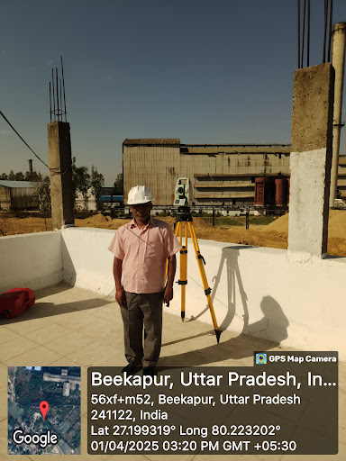
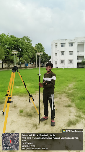
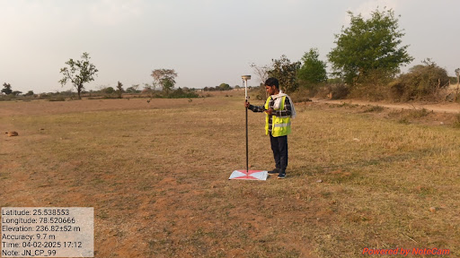
A DGPS survey is the process of using DGPS technology to determine the precise geographic coordinates (latitude, longitude, and often elevation) of specific points on the Earth's surface. Key Aspects of a DGPS Survey: * Objective: To obtain highly accurate positional data for mapping, boundary demarcation, construction layout, infrastructure monitoring, asset location, etc. * Equipment: * Base Station: A DGPS receiver set up over a known control point. * Rover Unit: One or more mobile DGPS receivers used to measure the unknown points. * Data Collector/Controller: A device (often handheld) used to manage the survey, record data, and sometimes control the rover. * Communication Link: Radio modems (or other means) to transmit corrections from the base to the rover(s). * Survey Software: For planning the survey, processing the collected data, and generating final outputs (maps, coordinate lists). * Techniques: * Real-Time Kinematic (RTK): The most common high-accuracy DGPS survey technique. Corrections are transmitted and applied in real-time, providing centimeter-level accuracy instantly in the field. Requires a continuous radio link. * Post-Processed Kinematic (PPK): Raw satellite data is recorded at both the base and rover simultaneously. Corrections are applied later using office software. Useful when a real-time radio link is unreliable or unavailable. Can achieve similar accuracy to RTK.
Types of Land Surveys Land surveyors perform various types of surveys based on specific needs. Here's a table summarizing some common ones: | Type of Survey | Description | |---|---| | Boundary Surveys | Determine property lines and corners. | | Topographic Surveys | Map the earth's surface, including elevations and natural features. | | Construction Surveys | Establish reference points for building and infrastructure projects. | | ALTA/NSPS Land Title Surveys | Comprehensive surveys for property title insurance. | | As-built Surveys | Document the final configuration of a constructed project. | | Hydrographic Surveys | Map water bodies and their features. | Surveying Equipment Land surveyors use a variety of tools and technology for accurate measurements. Here's a table listing some common equipment: | Equipment | Description | |---|---| | Total Stations | Combines theodolite, distance meter, and electronic data collector. | | Global Positioning System (GPS) | Utilizes satellites to determine precise locations. | | Level | Measures differences in elevation. | | Data collectors | Store survey data electronically. | | Drones | Used for aerial photography and data collection.
A land surveyor is a professional who measures and maps land. They use specialized equipment and techniques to accurately determine property boundaries, elevations, and other land features. This information is crucial for various purposes, including: * Construction projects: Providing accurate data for building design and layout. * Property disputes: Resolving boundary conflicts and establishing property lines. * Mapmaking: Creating detailed maps for various uses, such as navigation and planning. * Mining and resource exploration: Identifying and mapping valuable resources. What Does a Land Surveyor Do? * Fieldwork: Spending time outdoors, using equipment like GPS, total stations, and levels to collect data. * Data analysis: Processing collected data to create accurate maps, plans, and reports. * Legal research: Studying property records and legal documents to determine land ownership and boundaries. * Calculations: Performing complex mathematical calculations to determine distances, angles, and areas. * Communication: Explaining technical information to clients and other professionals in a clear and understandable manner. Essential Skills for a Land Surveyor * Strong mathematical and analytical skills: Accurate calculations are crucial for the job.